


- The rough, jagged mountains of the Selway-Bitterroot Wilderness make other mountains in Montana look like fluffy hills.
- Access to hundreds of miles of trails just outside the Bitterroot Valley.
- Home to the largest elk herd in the United States.
- Over 1,000,000 acres waiting to be explored.
Overview
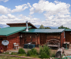
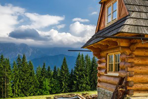
The Selway-Bitterroot Wilderness with 1,340,460 acres under protection is the third largest wilderness area in the lower 48 states. Expanding across the Idaho border into Montana, this glaciated terrain of ridged and towering peaks that drop into deep valley corridors make other mountains in the area look like fluffy rolling hills.
Trapper Peak, found in the Bitterroot Mountains, holds the record for tallest peak at 10,157 ft. But more than big peaks are found here, so is an abundance of big game. The Selway-Bitterroot Wilderness is home to the largest elk herd in the United States and is one of the reintroduction sights for gray wolf packs.
Flowing 47 miles right through the center of this wilderness is the Selway River. With peaks, valleys, animals, flora, and rivers, the Selway-Bitterroot Wilderness holds a new adventure with each turn.
Location/Information
The Selway-Bitterroot Wilderness is located in southwestern Montana and southeastern Idaho. Separated by the mere 600-foot wide Nez Perce Trail, commonly referred to as Magruder Corridor, the Frank Church-River of No Return Wilderness lies directly south of the Selway-Bitterrrot area, creating almost 3 million acres of undisturbed protected land.
The easiest access to the Selway-Bitterrot Wilderness is found in the Bitterroot Mountains. From Hwy 93 look for forest service access signs or continue on Hwy 12 for more access points.
With such a grand amount of land under protection, the management duties are divided among four National Forests: Bitterroot, Clearwater, Nez Perce, and Lolo. For maps or questions about the Selway-Bitterroot Wilderness contact one of the national forest offices.
Bitterroot National Forest
6735 West Fork Road
Darby, MT 59829
Phone: 406-821-3269
Fax: 406-821-1211
www.fs.usda.gov/bitterroot
Activities
The Selway-Bitterroot Wilderness offers something new every time you visit. Hike one of the massive peaks or dip into the lower canyons which are covered in dense coniferous forest, raft down the Selway, sit quietly and commune with nature, you name it, it has it!
Hiking
Over a million acres to be explored. From Missoula, the easiest access points are found in the Bitterroot Mountains. Or if you are looking to head out for the weekend, go a bit further into Idaho. Here, the Nez Perce and Clearwater National Forest portions of the Selway-Bitterroot Wilderness Area hold another bounty of breath taking scenery.
The following hikes are relatively close to Missoula.
- Sawtooth Creek Trail: This 12 mile moderate to difficult hike takes you along the beautiful Sawtooth Creek, home to westslope cutthroat trout. Don't worry if you lose this trail as it fades in and out of sight. Luckily, it tends to hug the creek, so stick to the creek and the trail will again reveal itself. Try your luck at fishing along the way. From Missoula, take Hwy 93 south, four miles past Hamilton to Roaring Lion Road. Turn west and you'll reach the trailhead. This is the trailhead for Sawtooth Creek Trail, as well as Roaring Lion Creek Trail and Ward Mountain Trail.
- Mill Creek Trail: Looking for something a bit shorter, the Mill Creek trail is it. Just 3 miles in you will reach a cascading waterfall with a deep pool. Stop and enjoy lunch here before hiking another half mile to another deep pool. From Missoula, take Hwy 93 south to Dutch Hill Road at Woodside. Head west to Bowman Road and take a left and then a right at Mill Creek. The refurbished trailhead is about a mile up the road.
Biking
Mountain biking is not allowed in wilderness areas, but if you want a glimpse of this beautiful landscape you can ride Magruder Pass. A 101 mile trail from Red River, ID to Darby, MT that connects the Selway-Bitterroot Wilderness and the Frank Church-River of No Return Wilderness. Just no deviating from the trail or you will be subject to fines.
Fishing
With well over 100 mountain lakes and countless streams, fisherman rejoice. Trout fishing will not disappoint in this neck of the woods. Even in the remote wilderness you need to obtain a permit.
You can contact Montana Fish, Wildlife, and Parks or stop in a local fly shop, they should help you with local hatch insight and may even reveal a secret gem.
Rafting
Pristine waterways run through the Selway-Bitterroot Wilderness, both the Selway and the Middle Fork of the Salmon Rivers are prime white water. In hopes of maintaining the integrity of the rivers and to protect the watershed, you'll have to apply for a lottery permit if you want to raft or float between May 15 to July 31.
Contact the West Fork Ranger Office in the Bitterroot National Forest for further lottery details. Phone: 406-821-3269.
Horseback Riding
With so much land to cover, why not use four legs instead of two. Horseback riding and horsepacking are allowed in the Selway-Bitterroot Wilderness Area. If packing in you must use weed-seed-free feed, we wouldn't want those horses spreading invasive species.
Hunting
Elk, deer, and mountain lions attract many a big game hunter. To go even bigger, obtain a permit and try your luck with a moose or bighorn sheep.
For hunting permits and regulations contact the Montana Department of Fish, Wildlife, and Parks.
Snowshoeing
Where there is snow you can snowshoe. Strap on a set of snowshoes and head out for a day of winter wonderland exploration. Don't have your own snowshoes, check for rentals at some of the gear shops in Missoula.
Downhill Skiing
Backcountry skiing is the name of the game. Skin up and start hiking. Practice your turns at Lolo Peak, 9,096 ft and then move over to Trapper Peak, 10,157ft, a mere 5-mile vertical hike up Trail 133 off Lavene Creek Road.
Just as you start to tire, that is with approximately 2 miles left, the tree line will fade away revealing epic views, an instant pain distraction.